Hotline : +951 504888, rsvn@airbagan.com
Online Reservation : +951 513300, onlinersvn@airbagan.com
WEATHER FORECASTS
Weather Report for Flooded Regions in Myanmar
Meteorologist: Marc de Keyser
Contact: marc.achiel@gmail.com or mobile +32 473 72 76 41
Date: 21 August 2015
Forecast valid for the 21th of August - based on the 20/00utc run
Synoptic situation
We can see two main low pressure features on the Synoptic map for SE Asia: the first one is the low pressure belt over North India which extends Eastwards towards the North of the Bay of Bengal and Northwestern Myanmar. The second low pressure feature is the tropical cyclone which currently can be found neat the North of the Philippines and will track Northwards during the next 24 hours. Once this feature is East of Taiwan it will move Eastwards again. So there is no danger for Myanmar to be hit by this tropical cyclone.What will happen is that those two low pressure feature will connect somewhere near Myanmar, which pushes away the high pressure ridge that gave us a few days of stable weather.
So today and tomorrow we will have cyclonic conditions which means that convective clouds will develop which will result in showery and thundery outbreaks at most inland locations of Myanmar.
Distribution of rain, showers and thunderstorms:
- between 00-06utc:during the first hours of the day most inland areas are dry, except for the district of Shan and Sagaing where some isolated rain/showers may develop. There is a lot of precipitation along the coastal areas of the district of Rakhaing, especially towards the northern parts of this area. Also over the coastal areas of the districts of Ayeyarwaddy, Mon and Tanintharyi there is rain and showery rain; Take in account that during the second part of this period, due to diurnal heating convective clouds form and this will result in frequent showery outbreaks over most inland locations.
- between 06-12utc:
during this period a lot of inland convective activity with showery and local thundery outbreaks. This can happen at most inland locations, but especially the district of Shan will get a lot of precipitation. The rain along the coasts grows a little less but there is still rain over the North of Rakhaing and along the districts of Mon and Tanintharyi
- between 12-18utc:
most convective activity will gradually die out and showery and thundery outbreaks become less intense and frequent , eventually ceasing almost everywhere. We can see that the intensity of rainfall increases again over the coastal areas: again along the whole of the coastline of Myanmar there is intense rainfall-especially over the coast of the districts of Rakhaing and Mon.
- between 18-24utc:
most inland location are dry at this moment, except for the district of Sagaing where still some isolated showers may develop. Rain fall stays important along the coastal areas of Myanmar. There are a few real active cells developing over the Bay of Bengal, one of the is moving by the end of this period towards the South of the district of Ayeyarwaddy and an other one towards the district of Tanintharyi.
Warnings
- tonight after 15/18utc heavy showery/thundery outbreaks may affect the Southern parts of the district of AyeyarwaddyMeteogram | Pressure | Relative Humidity | Cloud Cover | Precipitation | Satellite Image | Surface Wind | Temperature
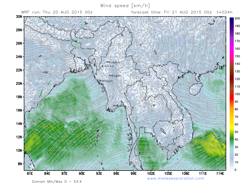
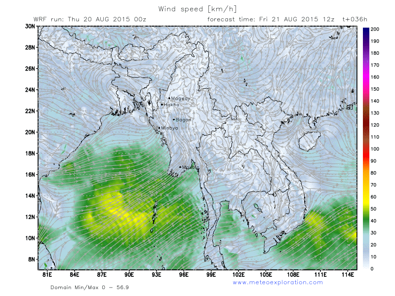
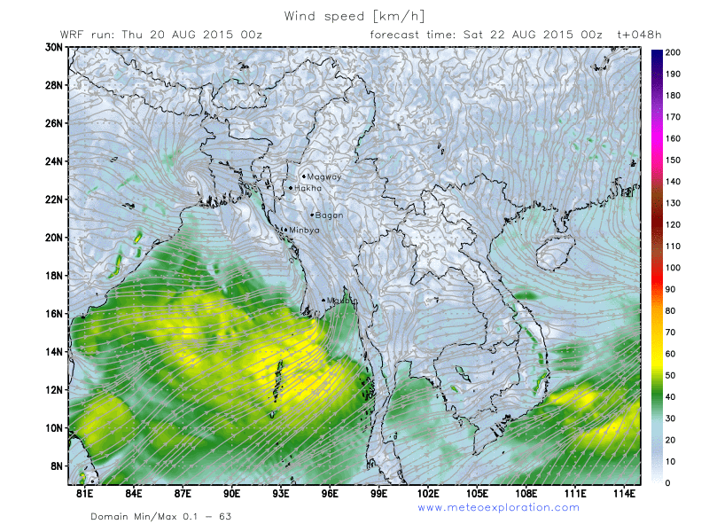
Surface Wind


